SIM PUBLISHING

Home     Publications     Artwork     News     Links     About


WATER ROCK & ICE
Adventures on the Left Coast

An exhibition of drawings and photographs by Gary Sim


Installation view of part of the exhibition

July 29 - August 19 2025 at West End Community Centre, 870 Denman Street

This exhibition of drawings and photographs is essentially autobiographical. It shows some of the places along the coast of British Columbia that I have travelled to over a long period of time, starting in the 1970s.


COASTAL DEFENSE
I went for a hike in Lighthouse Park, West Vancouver one day when I felt like getting out of the West End. The tide was fairly low when I got there, and I was able to get out onto a rock that was slightly offshore so that I could take a photograph looking back at the Point Atkinson lighthouse and the abandoned World War Two searchlight bunker. The drawing is done with pen & ink, graphite pencil, and Prismacolor pencil.


Incoming wave at Sombrio Point, 1976
In 1976 I was working for the telephone company in Victoria. A typhoon blew in from the Pacific Ocean and it rained heavily for over a week. The storm finally passed, and I drove up the west coast of the Island to Sombrio Point with my friend Murray Rae. It turned out that there were incredibly big waves coming in and literally shaking the ground as they crashed into the rock shore. I gave my camera to Murray and told him to take a picture of me standing on a large rock so that a sense of scale could be gained later as to how big the waves were. I got onto the rock just as another huge wave came in out of nowhere.


Incoming wave at Sombrio Point, 1976
Another one of the huge waves landing, a little earlier in the day. The rock I was standing on in the previous photograph is seen in profile in the lower left corner, although the scale of the two photographs is different. Sombrio Point is visible on the right through the haze of salt spray, it is 75 feet above waterline.


Incoming wave at Sombrio Point, 1976
Another wave, perhaps 50 to 60 feet high, has reared up out of the ocean and is advancing rapidly towards the rocks. Sombrio Point is seen fairly clearly at the upper left. These waves actually roared and hissed as they approached, and the sound of them crashing into the shore was literally deafening.


SUNSET, SCIMITAR ICEFALL
On our descent from Mt. Waddington, we decided to camp in the top of the 3,000 foot high Scimitar Icefall to get out of the wind. The lower summit is barely visible in the distance.


SOURCE OF THE SCIMITAR
We spent an entire day hiking down the Scimitar Glacier, before finally running out of smooth ice to walk on. Amidst the terminal moraine of the glacier a green creek emerges from underneath it.


VIEW FROM THE SUMMIT, LIGHTHOUSE PARK
I started this pencil drawing "en pleine aire" while sitting on a rock admiring the view. It got too hot in the sun so I was forced to retreat, and finished the details at home.


TOWER
This is the top tower for the Grouse Mountain Skyride, just before it arrives at the summit terminal. The lake formed by the Cleveland Dam is visible far below.


NORTHERN PROSPECT
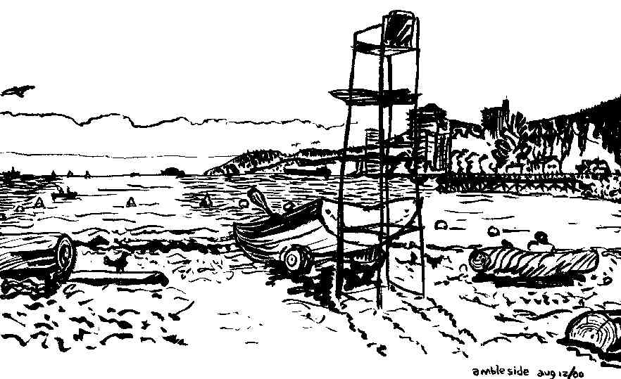
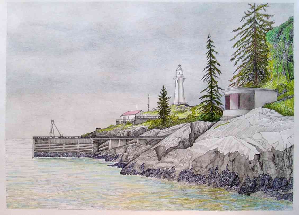
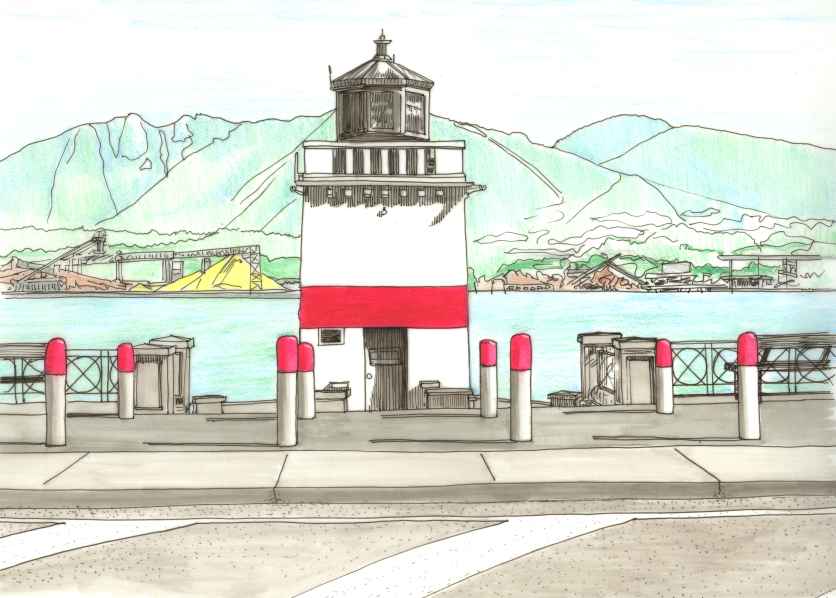
This ia view of the Brockton Point lighthouse in Stanley Park, Vancouver. This version of the structure was built in 1914, an earlier wooden one was demolished. Both versions of the lighthouse had a lifeboat station beside them. The lifeboat sat on a rail trolley in the boathouse, and was launched by rolling the trolley down the rails into the harbour. The remains of the actual rails, and the ramp that supported them, are still visible at low tide if you know where to look. The yellow pile in the distance is prilled sulphur. The drawing is done double-sided on drafting vellum with pigment pen & ink, graphite pencil, Prismacolor pencil, and india ink brushpen.


ROC JAC, SETON LAKE
The Roc Jac was an old logging skidder that had been converted to a rock drill. A compressor was mounted behind the cab, and a very articulate boom and drill were mounted on the front. This was the beginning of the Seton Lake salvage job for BC RAIL.


SLIDE, MILE 140.3
A huge rock slide took over 1,000 feet of railway rails and ties from the BC RAIL mainline and dragged them into the east end of Seton Lake. The slide also smashed out a concrete retaining wall, which is seen being repaired in the lower center of the photograph. The photograph only shows about the lower half of this 800 foot high cliff of rotting rock.


LUND HARBOUR
Lund harbour is on the British Columbia mainland north of Powell River, but it isn't that easy to get there. The Lund water taxi will take you even further ... to Savary Island in the distance on the left, to Hernando Island on the right, or perhaps even over to Vancouver Island, lost in the distance across the Strait of Georgia.


SAVARY SHELLS
I spent 10 days on Savary Island in a beachfront cabin. Much of my time was spent wandering around the beach, especially at low tide, and collecting shells. This watercolour painting with pen & ink was done from life, after I put a selection of shells on the kitchen table. They are all illustrated life size ... oyster, clam, mussel, geoduck, moon snail, and sand dollar.


GARIBALDI
This drawing is done from a photograph that I took while flying up to Williams Lake for an architectural site visit to a project in 100 Mile House. For some reason the pilot was flying at about the same height as the mountains around us. Mt. Garibaldi is on the right, Garibaldi Lake is still partially covered with ice, and the Barrier at lower right plugs the lake from draining into the Cheakamus Valley.


CHINOOK / COMBATANT
This Chinook rescue helicopter was flying over our camp at 9,700 feet in the Mt. Scimitar / Waddington Col.


THE DESCENT
The helicopter that was going to pick us up from the Col went down and has not been found. After 2 days of waiting we decided to start climbing down and out, along the Scimitar Glacier. This view shows two ropes of climbers who have rapelled 400 feet down a sheer ice face. Another rope of climbers is going down the set ropes, and my rope is waiting our turn.


THE SENTINEL
This imposing rock bluff faces north from Haida Gwaii, looking across the 50-mile wide Dixon Entrance towards the southern Alaskan islands.


AMBLESIDE
I drew this with a Japanese brushpen one lovely summer day while sitting on Ambleside Beach in West Vancouver. I was there with my girlfriend and her two Taiwanese home-study students, it was a summer idyl.

Home     Copyright 2025